

.JPG)
Leaving our cozy open invite 'beach refuge' in WA State; and pointing Betsy's nose towards Kingsburg-CA ;-)
March 18th: We were up around 5 AM … but dinked around drinking coffee, taking our time to tear down-hook up, & say good-bye to David for a few months, until around 10 AM - when Holland started rushing me to get on the road to make Longview around Tim's lunch break at noon.

We still had to fill propane tanks, and dump all Independence's water holding tanks.
I laughed when I saw the propane tank: Holland had told me earlier this month that it had been painted like a yellow submarine - but seeing it mimic The Beatle's "Yellow Submarine" song, had me laughing.
It was a good start to a good, sunny Day of new adventuring ;-)
.JPG)
Long Beach Propane station got a new look w-a new roof; faces L to R - John, Paul, George & Ringo ;-)
The Beatles - "The Yellow Submarine" song:
(https://www.youtube.com/watch?v=m2uTFF_3MaA)
Holland was feeling a lot of pain in his left knee, so I said, "I didn't get a chance to weight lift this morning, so how about letting me do the propane tanks today? I need to know how to work them anyway, in case I have to at some point." He agreed - so, I took the 3 empty "baby tanks" over to the submarine station - and walked the full tanks back (each weighing 25-lbs. full), and set them in place (those screw-wing nuts secure bands are really difficult!) and was amazed Holland had been able to get them back in place e.v.e.r.y.s.i.n.g.l.e.t.r.i.p. without losing his temper: I have little hands, and there was barely room for my hands to work the secure adherence set-up - his hands are bigger, and not as agile as mine. I'm going to brainstorm, and see if there is another way for us to get those tanks in and out of their cubby holes, without the screw/wing nut silliness.

Betsy & Independence; Active Enterprises, Inc. Propane & RV Supplies~#1318 Pacific Ave, Long Beach, WA

Propane tank rectangle cubby hole.
A comfortable 75 pound weight lifting workout this morning ;-)


Then we headed to Longview, where we'd unload the pedal bikes before heading down the freeway towards Kingsburg-CA.

We gifted Tim & his wife with the pedal bikes we'll never use …

They won't be taking up space anymore on Independence's back bumper …

Goodbye WA; hello New Adventures!


The sky was busy with air traffic … crossing the bridge near Talley Way-Longview & watching a jet air stream, I was thinking, 'people are going places today, like we are …'


We would be taking the Interstate 5 all the way.

Mt. Hood, crossing the bridge from WA to OR

People both sides of the Columbia River, are angry about the toll bridge proposal.
Rumor has it that demonrat governing officials on both sides of the Columbia River want to make this bridge a toll bridge, again … and apparently, WA's nazi insleeze and OR's dim-witted brown, wants to make all the river crossing bridges toll bridges :-(
The day was warming up with a 70-degree temp reading, around Eugene-OR, and I was regretting the sweatshirt pullover I put on this morning - but with nowhere to pull over, I had to tough it out.
The goal was to make Medford-OR, and find a place to hole up overnight: I'd change my top before we pulled out in the morning.
Things changed when we woke up.

Pulled in here around 3 PM, for a short cat-nap; Santiam Rest Area; Jefferson-OR
%20via%20US-26%20E%20and%20I-5%20S.JPG)
Santiam Rest Area-OR from Long Beach-WA 3 hr. (164.2 mi) via US-26 E and I-5 S
%20via%20I-5%20S.JPG)
Eugene-OR to Medford-OR; Eugene to Medford 2 hr. 46 min (167.7 mi) via I-5 S
Possible snow in the mountain Passes was worrying Holland; he woke up wanting to push on over Grant's Pass - and all the summits in between; and I'm always in the mood to be on the move :-)
He asked me to look up the timeframe from Medford to Fresno, on my Tablet: we were hoping and praying the roads would be clear for easy forward movement.
We were making good time - everything was in our favor.
%20via%20I-5%20S%20and%20CA-99%20S.JPG)
Medford-OR to Fresno-CA; 7 hr. 50 min (477.0 mi) via I-5 S and CA-99 S

The summits between Medford-OR to Grant's Pass-OR; Canyon Creek Pass was singled out to be 'green sign' listed at 2,020 ft. among these lower elevation {Pass} towns, averaging between 1,381 ft. to 1,949 ft. (Ashland), leading into the Siskiyou Pass between OR and CA.
When things are going too good, rule of thumb is to not get too comfortable …
Snow showing in the mountains before Ashland-OR

Merlin was advertising Diesel fuel - that's where the sketchy adventure began.
We turned off an off-ramp at Merlin-OR to get diesel, and couldn't get into any of the gas stations - too tight, and too low; looking for a way to get out of this mountain town with apparent 1-way traffic, we saw a sign pointing us in the direction of I5 … and followed the guiding sign.

A wood refuse burner! I haven't seen one of these since the Crown Zellerbach Shake Mill burner blew up in Cathlamet, in 1975 - Holland had never seen one, so I explained to him what they were for ;-)
Teepee Burner:
(https://en.wikipedia.org/wiki/Beehive_burner)
A little further down the road we saw another road sign saying "no through road".
What the heck.
GPS had not been thumbing her nose at us the entire trip, but I pulled out my phone anyway: no signal. I tried my Tablet (sometime this will work when the phone won't); also no signal. Holland pulled over to the side of the road to try his phone (sometimes he can get a signal when I can't); also no signal. Holland said, "We saw the sign pointing this direction, so we know it goes through; the road may not be open until the weather up here warms up more - or, maybe it's washed out. There's no where to turn around here, so let's go a little further and see if we can find somewhere to turn around."

Cautiously driving forward with eyes peeled to find a large turn-around area … we saw a vehicle parked off the road a bit; so, I rolled my window down and asked the girl on the phone if this road goes through or not. She said, "Yeah, it goes through" (then she looked at the size of Independence), and added, "but it's real winding" (making a snaking motion with her hand): there's a fishing place up the road a head that may have a parking lot big enough for you to turn around in. It's called Hog Creek."
We thanked her, and drove forward praying the 'fishing place' would have wide enough parking area that wasn't jam-packed with fishermen's vehicles.
Elohim graciously took mercy on us, & the turn-around was possible :-)
Thank the Lord!~Hog Creek, Merlin-OR
Merlin permanently checked off as done & d.o.n.e. LOL
%20%C2%B7%20via%20I-5%20S.png)
Talent-OR from Merlin-OR; 44m (44.3 mi) · via I-5 S
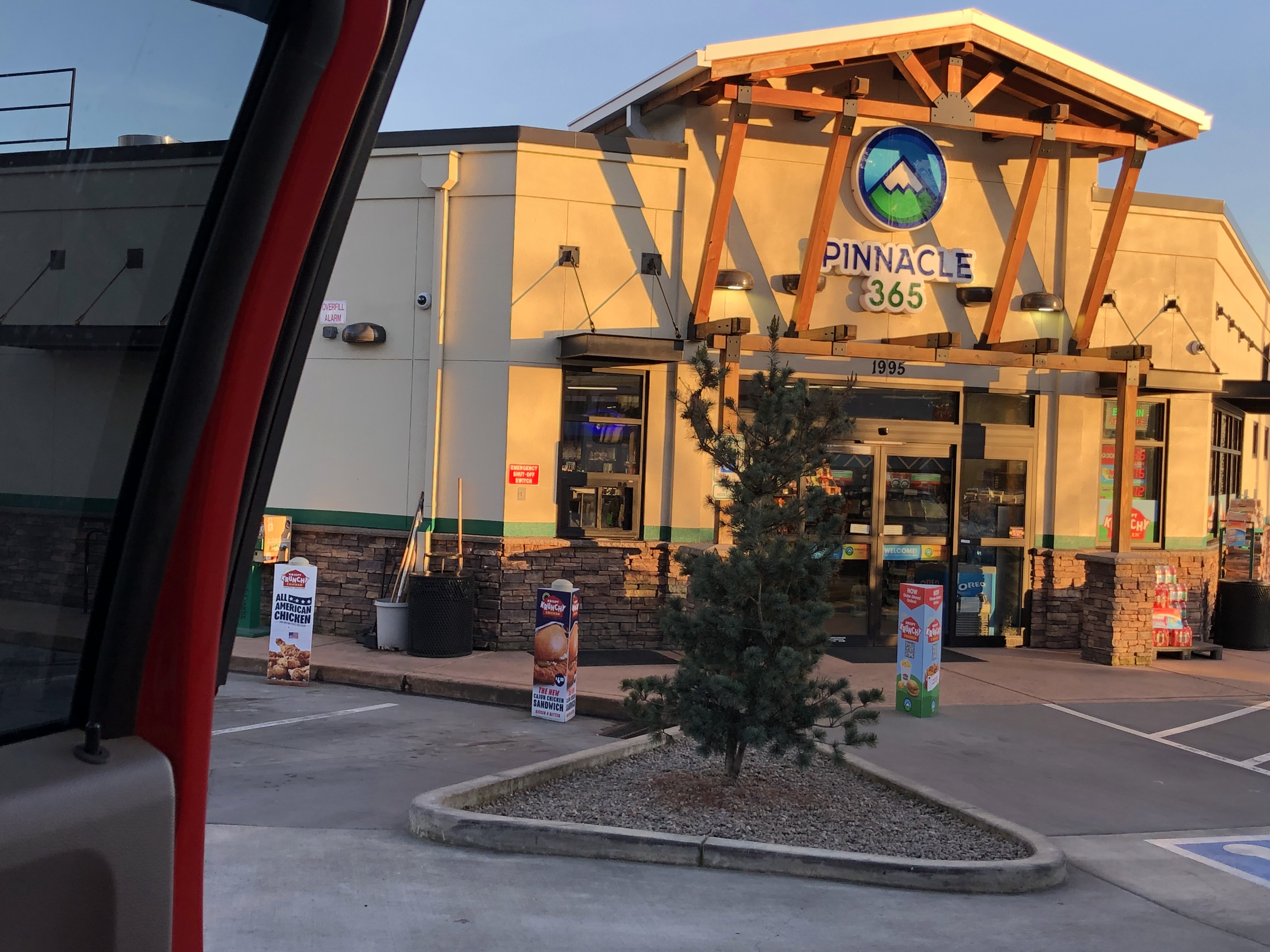
Pinnacle 365; 301 W Valley View Rd, Talent, OR
.JPG)
Filled Betsy's tank at Talent-OR, & she took us all the way to CA ;-)
Fueled with the Redbull I bought Holland while Betsy was filled, and drinking my Vanilla-flavored-Coke, we made Grants Pass without any further snafu's - and Holland was hoping there wouldn't be any going forward. This Pass is the one Pass that gives Holland a migraine headache, just thinking about it.
Grant's Pass, located at the Oregon Summit (also referred to as Siskiyou Pass) is the highest point on Interstate 5 (I-5) in the state of OR.
It was dark when we drove over the Siskiyou Mountain Pass; if there was snow on the ground, we couldn't see it. The road was not icy, and the drive went well.
Holland was glad to have had such an easy drive (temperature & weather wise); he pulled over at the first Rest Area he saw.

Mt. Ashland-OR~7.23 PM
Ashland-OR:
(https://en.wikipedia.org/wiki/Mount_Ashland & https://www.fs.usda.gov/wildflowers/regions/Pacific_Southwest/MtAshlandSiskiyouPeak/index.shtml)
Sunset seen in Medford-OR; 7:31 PM

.JPG)
Evening temperature is wonderful ;-)

Snow on the shoulders passing thru Ashland-OR; Siskiyou Summit Marker; I5 Pass between OR & CA
%20via%20I-5%20S.png)
Randolph E. Collier Northbound and Southbound Rest Area from Ashland-OR; 37 min (27.7 mi) via I-5 S
Pulled in among some semi's at a Rest Area and slept for 2 hours; Hornbrook, CA
It was still dark when we opened our eyes back up, and decided to keep moving forward. We were now in the Shasta Valley of the Siskiyou foothills (though still at a 2,500 ft. elevation), the "worst part" of the journey survived; and Holland was relaxing as we passed through Yreka and listened to some Eagles tunes, after we woke up.
Eagles - Desperado - Full Album, 1973/Hits & Best Songs Playlist 2024:
(https://www.youtube.com/watch?v=CQhzrpZztl4&list=PLgaFNC_I_ZknzYZKOQZpMnZAkPN2utIxI)
I was listening to the music, occasionally glancing up to see road signs pass by, and playing a mind game on my Tablet (it was night time - there was nothing else to engage my eyes); the last road sign I read was "Mt. Shasta City", before Holland said, "Look Baby - there's Mt. Shasta." I could barely see it in the dark, but I saw enough of it's gleaming white sides to know we were very close to it.
%20via%20I-5%20S.JPG)
Mt. Shasta City-CA from Hornbrook-CA; 54 min (52.6 mi) via I-5 S

My first glimpse of Mt. Shasta was in the dark! It's barely discernable … 10:23 PM
Mt. Shasta:
(https://en.wikipedia.org/wiki/Mount_Shasta)
Holland talks about this mountain quite a lot: I wish I had been able to see {Holland's Mountain} more clearly!
Made Redding-CA … pushing on to Sacramento-CA
My Honeymoon trip to San Francisco was my 1 and only drive thru there. LOL
'One Month Wedding Anniversary' Post:
(https://jeastofeden.blogspot.com/2023/02/one-month-wedding-anniversary.html)
%20via%20I-5%20S.png)
Sacramento-CA from Mt. Shasta City-CA; 3 hr. 30 min (219.8 mi) via I-5 S
Sacramento-CA skyline; 2.30 AM
Morning of March 19th was dawning, and Independence was put in some pretty interesting situations this road trip. She didn't have to brave stormy weather this time, but she did get dragged over some rough surfaces, and carefully guided through some tight spots.
The roads are bad no matter what State - or roadway we travel (byway, highway, freeway): the road surfaces are total crap. The States don't really fix the issues, they just spend skyrocketing $$$$$ to put cheap material Band-Aids on seriously hemorrhaging situations. Some of the detours are pretty sketchy … and the cones and cement medians set up to guide traffic, are real dangerous: there is not enough {safe} passage space for full-size vehicles (motorcycles and compact EV's can eek through, but it's hard for everyone else's vehicles - RV attached, or not) - what looks good on the paper drafts road construction contractors sell to governors and mayors, doesn't match the reality of actual road travel.
Road work in all three states is nonstop! And the thru passages keep getting tighter - and longer. GRRR!

%20via%20CA-99%20S.png)
Sacramento-CA to Kingsburg-CA; 3 hr. (188.9 mi) via CA-99 S
Around 5:30 AM, Holland pulled over and parked along the shoulder of an on-ramp. We were beat, and every Rest Area was filled to capacity with sleeping truck drivers and travelers … semi's had been parked along the entrance and exits of Rest Areas because Laws force them off the road after their specified Log Hours (timeframe they are allowed by Laws, to drive; their Log-In Book notations have to match their speedometer readings). There simply was "no room" at any {Inn} ;-)
We slept til nearly 10 AM; and reached our destination around noon - in orchard country.
Heat from sunshine woke me up, and a train whistle made me smile; people are going places ;-)

And back on the road again … Holland says we are about an hour from Kingsburg-CA

Blooming orchards: Kingsburg-CA
MADE IT!

Riverland RV Resort - Kingsburg:
(https://riverlandrvresort.com)
We registered, located our rented spot, unhooked/set-up, showered … and promptly went to bed (and peacefully slept hours away) to rest our weary bodies and relax our minds. It had been a long road gypsy trip ;-)
No comments:
Post a Comment