GOD KNEW I NEEDED YOU

Showing posts with label Mt. Hood-OR. Show all posts

Monday, July 1, 2024

THE GORGE-WA~Bucket List Drive


June 30th: Today is my grandson's 10th birthday - he's half grown now; the last time I saw his handsome face, and felt his happy hug was July 2nd, 2020; I has been asked to come celebrate his 6th BD & spend the weekend with him … and instead, we were all treated to a Hell storm; from which there would be no recoup:

EDUCATION OF THE ROAD VIRGIN: 
http://jeastofeden.blogspot.com/2020/07/education-of-road-virgin.html

I have weathered this Day every year pretty well since 2020; but the intense missingness got through today because my guard was down due to all the emotional upheaval that this year has dragged into my Life, making me vulnerable to the creeping sadness of loss.

I drank two cups of coffee while Holland snoozed, thinking I was holding up relatively well with a silent toast congratulating my little prince on his Special Day … and then … the tears started rolling down my face, and I couldn't rein them in. They just poured out until I was crying hard with a fist in my mouth (so I wouldn't wake Holland - he needs his sleep), and feeling a pounding headache coming on.

I knew I had to get away.


I would drive up the Gorge: empty my thoughts and become a sponge to the life happening around me. I would find peace along the long drive, and enjoy the happiness of a sun-drenched nature drive.

If I stayed in this motel room crying all day long, I would go crazy with grief.

So, I jumped in the shower - and when I came back out of the bathroom, Holland was sitting on the bed. I was still trying to stave off the burning tears behind my eyes while I ate a hurried breakfast - but the tears wouldn't stay hidden. When Holland noticed them, I started gathering up my purse, phones, Tablet, and light fleece pullover; and said I was going to drive up the Gorge to get out of my head, and relax. As an after thought, I asked if he'd care to join me.

He didn't know why I was crying so hard, but he said he would: and he did.

Neither one of us were dressed fancy - the windows would be down to enjoy the breezy warmth.

We left Woodland around 12:30'noon, and I didn't say much until we were well past Washougal. I don't talk much about my family; there is too much sadness woven through it; but not wanting my husband to think the tears were related to anything he'd said, or done, I finally said, "I'm missing my grandson." Holland doesn't know the situation, so he said, "Why don't you just call him?" Fresh tears fell before I said, "I'd do that if I could; but Stacey won't allow it - last time he tried to talk to me on the phone, Stacey angrily shut the phone off while he was happily chattering. Building bridges isn't Stacey's thing - setting fires is." Bless Holland, he said, "He'll grow up and try to find you." I just smiled weakly, and replied, "You don't know my daughter: Azariah is growing up without any mention of me; he probably doesn't even remember me, he was so little last time we saw each other. I don't want to think - or talk - about it anymore. My eyes burn, and my head aches. I just want to drive up the Gorge and forget the sadness."

CATHARSIS: https://jeastofeden.blogspot.com/2019/11/catharsis.html

Lenny Kravitz - 'I Want To Get Away' song: 
(https://www.youtube.com/watch?v=ewfVFBqOLgw)

By the time we reached Washougal, the headache had abated, and Holland had me laughing :-)

The Gorge is practically unrecognizable - there's so much development going on, and new housing going up … since this time last year, when we were in Washougal to get a bed box; it's like another world here. Rooftops along the skyline, everywhere you look :-(

There's walking trails, new Parks, new marinas being built: this end of the gorge is definitely being annexed into Portland's outskirt area.

We are working things out - Holland is fighting hard for US.
Lenny Kravitz - 'It Ain't Over 'Til It's Over' song:  
(https://www.youtube.com/watch?v=bqK0FhPTyxU)
I miss my grandson; I need to fly the coop for a while …
Lyle-WA from Woodland-WA; 1 hr. 44 min (93.5 mi) via WA-14 and WA-14 E
I hate these kind of cliff-&-sky-hanging roadways; but I braved it Solo Lobo a few years back.
Beacon Rock-WA:  (https://www.oregonhikers.org/field_guide/Beacon_Rock_Hike)
Beacon Rock Plaque #1
Beacon Rock Plaque #2

Lewis & Clark Trailblazing~Beacon Rock-WA: (https://lewis-clark.org/the-trail/down-the-columbia/beacon-rock/)

Charles E, Ladd; Beacon Rock, 1904: (https://www.yakimaherald.com/magazine/outdoors/beacon-rock-conquer-a-chunk-of-northwest-history/article_5bfba282-0d14-5786-afd6-337a67ea471b.html)

Beacon Rock polygons: The rock has great exposures of columnar basalt. As this lava cooled, it created five- or six-sided massive columns that can be as big as 9 feet in diameter and 90 feet long. When viewed from the top, the lava flow can look like the honeycomb of a beehive.

Henry Biddle; Beacon Rock, 1915 to 1918: (https://dedemontgomery.com/2017/03/23/biddles-rock-a-beacon-of-the-gorge/)

The hillsides, all along the gorge from Stevenson; were abloom in colorful arrays of wild blue asters, bright orange poppies, wild pink & white sweet peas, Queen Anne's Lace, cattails … and someone had planted Tiger Lilies up one sweep off the side of the Highway near the Bonneville Dam.

Bonneville Dam (https://en.wikipedia.org/wiki/Bonneville_Dam)

A freight train was blocking the gorge view …
Thankfully, Betsy's horsepower kicked in, and we outpaced it ;-)
I like seeing these train bridges - and I told Holland there are subsequent upcoming train tunnels.
The train tunnels run parallel to the highway tunnels …

Wind-surfing hydrofoil surfers; Holland had heard of them - this was the 1st time he's seen them.
We nipped into the Spring Creek Fish Hatchery parking lot to watch the surfing dare devils ;-)
An anchored  catamaran with a dinghy (WA Gorge = my pic today) & Internet pic showing the two pontoons.
Hood River Bridge.
Not as rugged as the high backcountry - but still a bit wild ;-)
Chamberlain Lake overlook Rest Stop-WA
We are just about to Lyle …

We made Lyle by 3 PM - weather was pleasingly hot, even with a breeze whipping up white-tipped waves on the river. The warmth felt good on our skin.

There's nothing special about Lyle-WA … it's just the furthest end of the Gorge, that I could run from my heartache this afternoon.

Lyle is just a little high country shot-gun-town in the Washington Gorge.
A milkshake was a fair exchange for the lovely drive ;-)

I like this drive up the gorge … and I'm glad Holland agreed to come along with me. Holland had done union construction jobs in Camas and Washougal, but the little towns we traveled through the gorge to Lyle were new to him - and it's been decades since I've visited them.

We did not cross the Hood River Bridge; Holland opted to treat me to the longer WA side all the way back to Woodland :-)

This drive has been on my Solo Lobo Bucket List for at least 3 years; this year it happened, and I had a traveling companion ;-)

A day that started out badly, ended with sunny happiness :-)

As we backtracked, we could see Mt. Hood on the OR side, peeking over the Hood River area.
Heart clouds around Vancouver-WA … affirmation that our comings and goings, are heavily guarded by our heavenly Father; Psalm 121:8
It was a good day~no milkshake … but Holland got his ice cream 'fix' ;-)
A page turner, hard to put down; I probably won't be in bed until dawn lights the morning sky ;-)

Wednesday, March 20, 2024

CA, HERE WE COME!~Long Beach-WA to Kingsburg-CA

Leaving our cozy open invite 'beach refuge' in WA State; and pointing Betsy's nose towards Kingsburg-CA ;-)

March 18th: We were up around 5 AM … but dinked around drinking coffee, taking our time to tear down-hook up, & say good-bye to David for a few months, until around 10 AM - when Holland started rushing me to get on the road to make Longview around Tim's lunch break at noon.


We still had to fill propane tanks, and dump all Independence's water holding tanks.

I laughed when I saw the propane tank: Holland had told me earlier this month that it had been painted like a yellow submarine - but seeing it mimic The Beatle's "Yellow Submarine" song, had me laughing.

It was a good start to a good, sunny Day of new adventuring ;-)

Long Beach Propane station got a new look w-a new roof; faces L to R - John, Paul, George & Ringo ;-)
The Beatles - "The Yellow Submarine" song:
 (https://www.youtube.com/watch?v=m2uTFF_3MaA)

Holland was feeling a lot of pain in his left knee, so I said, "I didn't get a chance to weight lift this morning, so how about letting me do the propane tanks today? I need to know how to work them anyway, in case I have to at some point." He agreed - so, I took the 3 empty "baby tanks" over to the submarine station - and walked the full tanks back (each weighing 25-lbs. full), and set them in place (those screw-wing nuts secure bands are really difficult!) and was amazed Holland had been able to get them back in place e.v.e.r.y.s.i.n.g.l.e.t.r.i.p. without losing his temper: I have little hands, and there was barely room for my hands to work the secure adherence set-up - his hands are bigger, and not as agile as mine. I'm going to brainstorm, and see if there is another way for us to get those tanks in and out of their cubby holes, without the screw/wing nut silliness.

Betsy & Independence; Active Enterprises, Inc. Propane & RV Supplies~#1318 Pacific Ave, Long Beach, WA
Propane tank rectangle cubby hole.
A comfortable 75 pound weight lifting workout this morning ;-)

Then we headed to Longview, where we'd unload the pedal bikes before heading down the freeway towards Kingsburg-CA.

We gifted Tim & his wife with the pedal bikes we'll never use …
They won't be taking up space anymore on Independence's back bumper …
Goodbye WA; hello New Adventures!
The sky was busy with air traffic … crossing the bridge near Talley Way-Longview & watching a jet air stream, I was thinking, 'people are going places today, like we are …'

We would be taking the Interstate 5 all the way.

Mt. Hood, crossing the bridge from WA to OR
People both sides of the Columbia River, are angry about the toll bridge proposal.

Rumor has it that demonrat governing officials on both sides of the Columbia River want to make this bridge a toll bridge, again … and apparently, WA's nazi insleeze and OR's  dim-witted brown, wants to make all the river crossing bridges toll bridges :-(

The day was warming up with a 70-degree temp reading, around Eugene-OR, and I was regretting the sweatshirt pullover I put on this morning - but with nowhere to pull over, I had to tough it out.

The goal was to make Medford-OR, and find a place to hole up overnight: I'd change my top before we pulled out in the morning.

Things changed when we woke up.

Pulled in here around 3 PM, for a short cat-nap; Santiam Rest Area; Jefferson-OR
Santiam Rest Area-OR from Long Beach-WA 3 hr. (164.2 mi) via US-26 E and I-5 S
Eugene-OR to Medford-OR; Eugene to Medford 2 hr. 46 min (167.7 mi) via I-5 S

Possible snow in the mountain Passes was worrying Holland; he woke up wanting to push on over Grant's Pass - and all the summits in between; and I'm always in the mood to be on the move :-)

He asked me to look up the timeframe from Medford to Fresno, on my Tablet: we were hoping and praying the roads would be clear for easy forward movement.

We were making good time - everything was in our favor.

Medford-OR to Fresno-CA; 7 hr. 50 min (477.0 mi) via I-5 S and CA-99 S
The summits between Medford-OR to Grant's Pass-OR; Canyon Creek Pass was singled out to be 'green sign' listed at 2,020 ft.  among these lower elevation {Pass} towns, averaging between 1,381 ft. to 1,949 ft. (Ashland), leading into the Siskiyou Pass between OR and CA.

When things are going too good, rule of thumb is to not get too comfortable …

Snow showing in the mountains before Ashland-OR
Merlin was advertising Diesel fuel - that's where the sketchy adventure began.

We turned off an off-ramp at Merlin-OR to get diesel, and couldn't get into any of the gas stations - too tight, and too low; looking for a way to get out of this mountain town with apparent 1-way traffic, we saw a sign pointing us in the direction of I5 … and followed the guiding sign.

A wood refuse burner! I haven't seen one of these since the Crown Zellerbach Shake Mill burner blew up in Cathlamet, in 1975 - Holland had never seen one, so I explained to him what they were for ;-)
Teepee Burner
(https://en.wikipedia.org/wiki/Beehive_burner)

A little further down the road we saw another road sign saying "no through road".

What the heck.

GPS had not been thumbing her nose at us the entire trip, but I pulled out my phone anyway: no signal. I tried my Tablet (sometime this will work when the phone won't); also no signal. Holland pulled over to the side of the road to try his phone (sometimes he can get a signal when I can't); also no signal. Holland said, "We saw the sign pointing this direction, so we know it goes through; the road may not be open until the weather up here warms up more - or, maybe it's washed out. There's no where to turn around here, so let's go a little further and see if we can find somewhere to turn around."


Cautiously driving forward with eyes peeled to find a large turn-around area … we saw a vehicle parked off the road a bit; so, I rolled my window down and asked the girl on the phone if this road goes through or not. She said, "Yeah, it goes through" (then she looked at the size of Independence), and added, "but it's real winding" (making a snaking motion with her hand): there's a fishing place up the road a head that may have a parking lot big enough for you to turn around in. It's called Hog Creek."

We thanked her, and drove forward praying the 'fishing place' would have wide enough parking area that wasn't jam-packed with fishermen's vehicles.

Elohim graciously took mercy on us, & the turn-around was possible :-)

Thank the Lord!~Hog Creek, Merlin-OR
Merlin permanently checked off as done & d.o.n.e. LOL
Talent-OR from Merlin-OR; 44m (44.3 mi) · via I-5 S
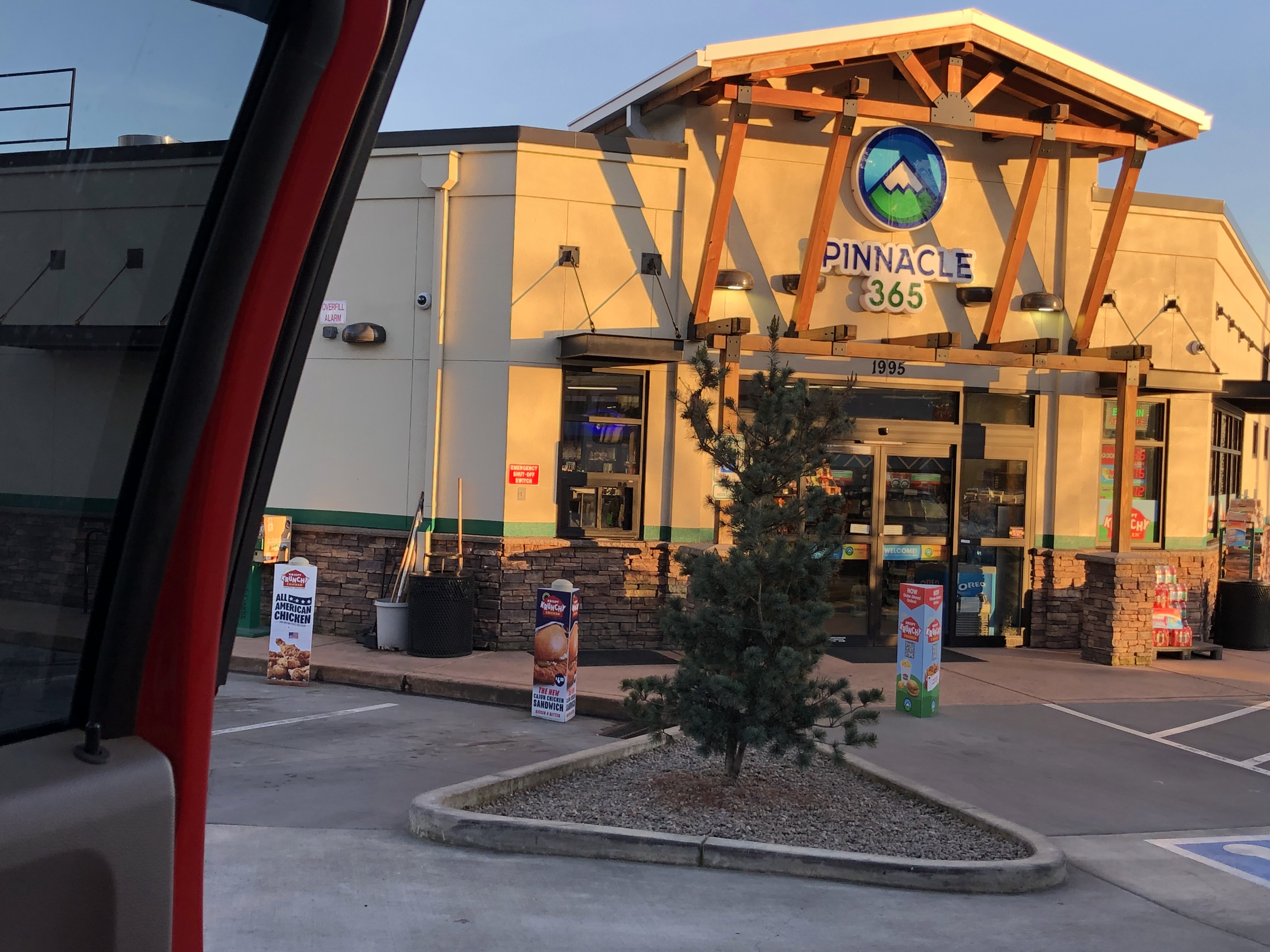
Pinnacle 365; 301 W Valley View Rd, Talent, OR
Filled Betsy's tank at Talent-OR, & she took us all the way to CA ;-)

Fueled with the Redbull I bought Holland while Betsy was filled, and drinking my Vanilla-flavored-Coke, we made Grants Pass without any further snafu's - and Holland was hoping there wouldn't be any going forward. This Pass is the one Pass that gives Holland a migraine headache, just thinking about it.

Grant's Pass, located at the Oregon Summit (also referred to as Siskiyou Pass) is the highest point on Interstate 5 (I-5) in the state of OR.

It was dark when we drove over the Siskiyou Mountain Pass; if there was snow on the ground, we couldn't see it. The road was not icy, and the drive went well.

Holland was glad to have had such an easy drive (temperature & weather wise); he pulled over at the first Rest Area he saw.

Mt. Ashland-OR~7.23 PM
Ashland-OR:
 (https://en.wikipedia.org/wiki/Mount_Ashland & https://www.fs.usda.gov/wildflowers/regions/Pacific_Southwest/MtAshlandSiskiyouPeak/index.shtml)
Sunset seen in Medford-OR; 7:31 PM
Evening temperature is wonderful ;-)
Snow on the shoulders passing thru Ashland-OR; Siskiyou Summit Marker; I5 Pass between OR & CA
Randolph E. Collier Northbound and Southbound Rest Area from Ashland-OR; 37 min (27.7 mi) via I-5 S
Pulled in among some semi's at a Rest Area and slept for 2 hours;  Hornbrook, CA

It was still dark when we opened our eyes back up, and decided to keep moving forward. We were now in the Shasta Valley of the Siskiyou foothills (though still at a 2,500 ft. elevation), the "worst part" of the journey survived; and Holland was relaxing as we passed through Yreka and listened to some Eagles tunes, after we woke up.

Eagles - Desperado - Full Album, 1973/Hits & Best Songs Playlist 2024:
 (https://www.youtube.com/watch?v=CQhzrpZztl4&list=PLgaFNC_I_ZknzYZKOQZpMnZAkPN2utIxI)

I was listening to the music, occasionally glancing up to see road signs pass by, and playing a mind game on my Tablet (it was night time - there was nothing else to engage my eyes); the last road sign I read was "Mt. Shasta City", before Holland said, "Look Baby - there's Mt. Shasta." I could barely see it in the dark, but I saw enough of it's gleaming white sides to know we were very close to it.

Mt. Shasta City-CA from Hornbrook-CA; 54 min (52.6 mi) via I-5 S
My first glimpse of Mt. Shasta was in the dark! It's barely discernable … 10:23 PM
Mt. Shasta
(https://en.wikipedia.org/wiki/Mount_Shasta)

Holland talks about this mountain quite a lot: I wish I had been able to see {Holland's Mountain} more clearly!

Made Redding-CA … pushing on to Sacramento-CA
My Honeymoon trip to San Francisco was my 1 and only drive thru there. LOL
'One Month Wedding Anniversary' Post:
 (https://jeastofeden.blogspot.com/2023/02/one-month-wedding-anniversary.html)
Sacramento-CA from Mt. Shasta City-CA; 3 hr. 30 min (219.8 mi) via I-5 S
Sacramento-CA skyline; 2.30 AM

Morning of March 19th was dawning, and Independence was put in some pretty interesting situations this road trip. She didn't have to brave stormy weather this time, but she did get dragged over some rough surfaces, and carefully guided through some tight spots.

The roads are bad no matter what State - or roadway we travel (byway, highway, freeway): the road surfaces are total crap. The States don't really fix the issues, they just spend skyrocketing $$$$$ to put cheap material Band-Aids on seriously hemorrhaging situations. Some of the detours are pretty sketchy … and the cones and cement medians set up to guide traffic, are real dangerous: there is not enough {safe} passage space for full-size vehicles (motorcycles and compact EV's can eek through, but it's hard for everyone else's vehicles - RV attached, or not) - what looks good on the paper drafts road construction contractors sell to governors and mayors, doesn't match the reality of actual road travel.

Road work in all three states is nonstop! And the thru passages keep getting tighter - and longer. GRRR!
Sacramento-CA to Kingsburg-CA; 3 hr. (188.9 mi) via CA-99 S

Around 5:30 AM, Holland pulled over and parked along the shoulder of an on-ramp. We were beat, and every Rest Area was filled to capacity with sleeping truck drivers and travelers … semi's had been parked along the entrance and exits of Rest Areas because Laws force them off the road after their specified Log Hours (timeframe they are allowed by Laws, to drive; their Log-In Book notations have to match their speedometer readings). There simply was "no room" at any {Inn} ;-)

We slept til nearly 10 AM; and reached our destination around noon - in orchard country.

Heat from sunshine woke me up, and a train whistle made me smile; people are going places ;-)
And back on the road again … Holland says we are about an hour from Kingsburg-CA
Blooming orchards: Kingsburg-CA
MADE IT!
Riverland RV Resort - Kingsburg
(https://riverlandrvresort.com)

We registered, located our rented spot, unhooked/set-up, showered … and promptly went to bed (and peacefully slept hours away) to rest our weary bodies and relax our minds. It had been a long road gypsy trip ;-)