GOD KNEW I NEEDED YOU

Showing posts with label Bucket List adventuring. Show all posts

Thursday, April 3, 2025

HINKLEY-CA; Barstow-CA


April 2nd: We pulled stakes in Kingman-AZ, hitched Independence to Betsy … and concentrated on following Elohim's lead into our Future 🙏

We're leaving AZ, this morning.

We loved AZ's warmth; but the constant devil winds and thin altitude air made breathing difficult for both of us. We did not know that the desert air would be worse for us than the humid rainforest coastal air of the PNW. I had always heard Drs. telling me that a drier climate would be best for my lungs … so, when in the Spring 2023 Holland agreed with me to sell the house on Longview-WA and travel the USA - making Yuma-AZ our long-term "home base" … I was elated! Holland had periodically lived all over the lower extremities of American States, and I was thrilled that I would get to see and experience those places with him - and make a home for us in Yuma, "the sunniest place in America!"

But that wonderful dream turned into a hellish reality, as we tried valiantly from 2023 to current 2025 to build a life "down south" on those hopes and prayers: we simply cannot breathe easy in any of the southern states - and Holland has faithfully ferried me to CA, NV, AZ, NM, & TX … doing, and going far beyond, to find a safe haven for us to rest our struggling lungs, and build a happy Life to enjoy our senior years.

NO GO 😕

While the air in Arizona can be dusty, doctors sometimes recommend it for people with lung issues because the dry, arid climate and lower humidity can be beneficial for certain respiratory conditions, especially compared to the humid climates of some other areas.

Reduced Humidity: Lower humidity in Arizona can help reduce the growth of mold and dust mites, which are common triggers for asthma and allergies. However, Arizona has a higher prevalence of certain lung diseases compared to other regions of the country - such as "Valley Fever" (Coccidioidomycosis) = this fungal infection is caused by inhaling spores of the fungus Coccidioides immitis, which is present in the soil in Arizona. It can cause a variety of symptoms, including fever, cough, chest pain, and shortness of breath: Arizona has a specialized Valley Fever Center that provides research, treatment, and education about this disease; "Chronic Obstructive Pulmonary Disease" (COPD) = this is a group of lung diseases that damage the airways and make it difficult to breathe; "Asthma" = Arizona's dry climate and dust storms can trigger asthma attacks in susceptible individuals. Somehow, this info is not mentioned by Drs. promoting AZ's "wonderful air for struggling lungs". Since we've been making our 6 month trips to AZ, since 2023, Holland has struggled with fever, cough, & shortness of breath: I have been struggling with shortness of breath - and have had several serious asthma attacks that have scared my poor husband when they suddenly happened. It wasn't until we were set up in Fortuna-AZ the winter of 2024, that I connected the dots 🤬 It was in Fortuna, that we realized that AZ was out of the question for "home base" - and we will probably never come back here again for a lengthy stay.

Dry Air: Dry air can make it easier for some people with respiratory conditions to breathe, as it can help reduce mucus buildup and make breathing feel less heavy. This has not been the case for us … I have struggled mightily to breath easy - no matter what part of the State we have hunkered down in. My chest always hurts trying to suck air into my lungs … and Holland's lungs never escape the mucus build up. He always quips, "I sound like a fricking cat with a hair ball it's trying to loosen." And I try not to laugh, because it is true - he does sound like a cat with a hairball 😉 But, it's really not a laughing matter because I know his chest is hurting with the constant hacking and spitting … but at least he is not spitting up on the floor, like a cat would do; and that is a blessing (no joke).

Lower Pollen Counts: While Arizona does have dust, it also has lower pollen counts compared to some other areas, which can be beneficial for people with seasonal allergies. Personally, I have not noticed this - my eyes always itch after a breeze loosens pollen and sends it my way … Fall and Winter in AZ is windy and carries dust & dried-out foliage refuse in the gusts - Spring and Summer in AZ is lush with new growth following rain showers - new growth comes with heady pollen fallout; and I am noticing that Holland is sneezing and blowing his nose more than usual. Seasonal lung issues are happening for us in AZ as in the PNW - the difference is, that there are the aforementioned desert lung complications thrown into the mix; and those new complications make our lung issues more complicated. More seriously deadly, due to the fact that compromised lungs do not rebound like healthy lungs would. In AZ, I have had 2 major asthma attacks that seriously worried both of us - I felt bad for Holland because he'd never seen a full-on asthma attack before: it is very scary, and seriously concerning. And I am concerned when he has a COPD flareup, because his lungs are more compromised than mine - when a fever sets in and the chest-pain coughing and hacking starts, it is a serious concern.
 
Specific Conditions: The dry climate of Arizona can be particularly helpful for individuals with conditions like chronic obstructive pulmonary disease (COPD) or asthma, as it can help reduce inflammation and improve lung function. FALSE! Holland was diagnosed with COPD years ago, and I married him with that full knowledge … and I have environmental asthma, which means that I only suffer asthmatic flareups and serious asthma complications when symptoms are triggered or worsened by exposure to specific substances or conditions in their environment, such as allergens, pollutants, or irritants. The dry climate of AZ has not been kind to our lungs 😟

Dust Concerns: It's important to note that while the air in Arizona is generally dry, it can also be dusty, especially during certain times of the year or in specific areas. People with lung issues should be aware of the potential risks of dust exposure and take precautions, such as staying indoors during dust storms or using air purifiers. We decided on AZ because of it's warm climate and what we were led to believe, it's "wonderful air": we did not know that we would be indoors 95% of the time while here; and that my hopes for "a year'round tan" would not be happening: I am going back up North, paler than when I left! Simply because we cannot get out of Independence, or Betsy, for any length of time without suffering an entire week following an outdoor venture 😒 We do have, and utilize an air purifier - that thing never shuts off; and still, our poor lungs struggle.

So, we are leaving AZ, this morning. Who would have thought we'd need to go back to the PNW to enjoy sun rays (skimpy as they may be), spend time outdoors, and draw a carefree breath (our lungs struggling only with seasonal allergies, not daily happenstance)? 🤔

Our route this morning.
Barstow-CA from Kingman-AZ; 3h 17m (206 mi), via I-40 W
The road out of Kingman, was horribly rough. Poor Independence.
Rain; nearing Needles-CA

The rain smelled good - it had a dusty odor, and taste … but also a very refreshing Spring rain scent.

This … blesses the desert, with color.
We left Kingman at 9.30 AM; we still have a way to go.
Low-lying fog hangs over the Providence Mountains-CA
CA roads are trash - it doesn't matter what type of road you travel. Just trash.
What is the weird looking building, in that field over there?

I went online to see if I could gather any info on this weird building that stands alone in a desert field, and came up with a couple explanations - none of which actually pinpoints what the thing is:

Internet pic 

a) It’s a GPS calibration device. These are scattered around the U.S. (but not overseas - GPS remains a U.S. military system). To continually refine the accuracy of GPS signals, calibration devices like this - basically, giant, hyper-accurate GPS receivers - constantly compare their GPS-computed position with their known location.

b) It’s a navigation beacon for aircraft, called a VOR, which stands for Very High Frequency Omnidirectional Radio Range.  It sends out signals - using frequencies only just slightly above those used by the FM radio stations, that tell aircraft their bearing from the beacon, and their distance, and allows planes to ‘see’ where they are in any weather, even in the absence of GPS or ground-based radar. While it may look high-tech, VORs are relatively ancient, first coming into use after World War II. This is what Holland believes it to be.

c) Remember Jodie Foster, Matthew McConaughey, and the Very Large Array of radio antennas in the movie Contact? This is part of another, less photogenic deep-space radio project. The signals from these sensors—there are nearly 300 across the country—are mathematically pooled together to create a virtual, continent-sized radio telescope. I'm settling on this [explanation] because AZ seems to be the gateway state to a lot of spacey stuff.

d) No one knows what these are - or rather, those who do won’t tell us. These sites, which were built after 9/11, are controlled by the Departments of Defense and Homeland Security, which will not release information about their purpose, other than that they do not produce “harmful radiation or interference.”

The Lavic Lake Volcanic Field, between Newberry Springs-CA & Barstow-CA
The Lavic Lake Volcanic Field:
 (https://en.wikipedia.org/wiki/Lavic_Lake_volcanic_field)
The new bridge in up, now = the old bridge is totally gone; Barstow-CA

The new North First Avenue Bridge; Barstow-CA. The original North First Avenue Bridge was built around 1930, spanning the Burlington-Northern-Santa Fe Railway intermodal yard, in Barstow-CA

Skanska Completes $30 Million Replacement of North First Avenue Bridge in Barstow: https://www.vvng.com/skanska-completes-30-million-replacement-of-north-first-avenue-bridge-in-barstow/

YES … yes, He does ;-); seen coming off the bridge, towards Skyline RV Park. Barstow-CA
Barstow-CA is on Route 66
Rock has been laid at Skyline - this is something new & it looks nice; it should keep the dust devils grounded ;-)
Skyline RV Park; #30384 Old Hwy 58, Barstow, CA

After we unhooked & set things right inside Independence, Holland suggested we drive to Hinkley-CA; it's not that far away, and we've been intending to get there for quite a while (every time we come to Barstow); now we need to make the time since we have decided this is our last trip this way, coming from AZ or going to AZ:

Hinkley-CA from Barstow-CA; 18 min (13.0 mi) via Old Hwy 58 and Santa Fe Ave
CA soulless politics and business practices suck.
The Hinkley Bible Church is still functioning.

Hinkley, California, is famously known as the "Erin Brockovich town" due to the landmark lawsuit and movie based on the real-life story of groundwater contamination by Pacific Gas & Electric (PG&E) with hexavalent chromium. The movie is based on true accounts, and 98% accurate.

Erin Brockovich Clip on Water: 
(https://www.youtube.com/watch?v=BGQGxJ4bqK4)

Holland wanted to check this place out; I prayed about it.
Psalm 121.7-8
I was listening to some Petra songs, this morning ;-)
Petra
(https://www.youtube.com/watch?v=QNvWU_DUATc&list=PL06A3-WmRbqh1ZtIv5rR7QC2XTDJt_y_5)

From 1952 to 1966, Pacific Gas and Electric Company (PG&E) dumped about 370 million U.S. gallons (1.4×10⁹ liters) of chromium-tainted wastewater into unlined wastewater spreading ponds around the town of Hinkley, California, located in the Mojave Desert.

The real-life Erin Brockovich, a real-life legal clerk, investigated the apparent elevated cluster of illnesses in the community linked to hexavalent chromium, and her efforts, along with those of the real-life lawyer Edward L. Masry, pitted and won a 1996 direct-action arbitration against PG&E, resulting in a $333 million settlement, which was the largest settlement ever awarded in a direct-action lawsuit in the history of the United States

In 1996, residents won a direct-action arbitration (a formal, out-of-court dispute resolution process) against PG&E, resulting in a $333 million settlement, which was the largest settlement ever awarded in a direct-action lawsuit in the history of the United States.

While the movie praised a successful win, the cleanup of the toxic contamination was a slow process … and the true results are that some wells in Hinkley-CA, still test at dangerously high levels of chromium-6.

Pacific Gas and Electric (PG&E) is still in business, having emerged from bankruptcy in 2020; and continues to operate as a major utility company in California, providing natural gas and electricity to approximately 16 million people across a 70,000-square-mile area in northern and central California.

Pacific Gas and Electric Company (PG&E) is STILL operating!
I couldn't believe what I heard! And I can't believe people are swallowing the BS
Acres of alfalfa - which is a worthless pursuit & a business stunt to pacify unscrupulous laws.

Hinkley-CA~No Hollywood ending for town plagued by toxic water: 
https://www.sbsun.com/2013/07/09/hinkley-no-hollywood-ending-for-town-plagued-by-toxic-water/

Toxic plume spreads, PG&E faces 2nd Hinkley suit: https://www.sfgate.com/science/article/toxic-plume-spreads-pg-amp-e-faces-2nd-hinkley-4688046.php

In the Hinkley area, PG&E is using contaminated water, containing hexavalent chromium (chromium-6), to irrigate alfalfa fields as part of a remediation effort, aiming to convert the toxic chromium-6 into a less harmful form, chromium-3, in the soil.

Alfalfa can be used for phytoremediation, a process where plants are used to clean up contaminated soil by absorbing and accumulating toxic elements. Alfalfa is a good candidate for this due to its large biomass productivity, high tolerance to potentially toxic elements, and strong capacity to take up these elements. 

Alfalfa watered with toxic water is likely unsafe to consume because contaminants in the water can be absorbed by the plant and accumulate in its tissues, potentially posing health risks; alfalfa that has absorbed these toxins can lead to various health problems - consuming animal products that have been fed with this alfalfa would be foolhardy. What are they going to do with all that alfalfa?

I was glad to leave Hinkley behind us, as we turned back towards Barstow.

Holland drove back to Independence on the backroad, saying with a smile and a wink, "My backroad Baby need her back road fix." It was a thoughtful thing to do - he prefers freeway driving; and I do need my back roads scenery fix, now and then 👩‍❤️‍💋‍👨

Driving through Barstow, towards Skyline, we pulled over so Holland could get his fix … anything and everything pertaining to cars or trucks, gets his immediate attention 😉

Old Hwy 58 from Hinkley-CA to Barstow-CA; 16 min (13.3 mi) via Old Hwy 58 and CA-58
Tom's Certified Welding & Machine Shop; #28664 US Highway 58, Barstow, CA


Tomorrow, we will take a drive to Victorville-CA, tracking down a phantom town:

Victorville-CA from Barstow-CA; 32m (32.2 mi) via I-15 S

Monday, March 24, 2025

SEILIGMAN-AZ DAYTRIP


March 19th: The weather was accommodating -  so, we drove Route 66 to Seligman-AZ, this afternoon 😁

We started in Kingman-AZ (where we have currently parked & visiting): and followed the original Mother Road, through various communities (now living ghost towns) along the way to Seligman, which would be today's goal point 👌

First stop in Kingman to grab a Red Bull & 2 Payday candy bars 😉
The distance between Kingman and Seligman, Arizona, via the historic Route 66 highway is approximately 87 miles.

We did not visit every site in Seligman, because the highway itself, was the main {draw} for me … but, we did visit several unusual and interesting sites along the way that caught our interest; and we did do a little sight-seeing in Seligman, as well as grab lunch fare at the Snow Cap 👍

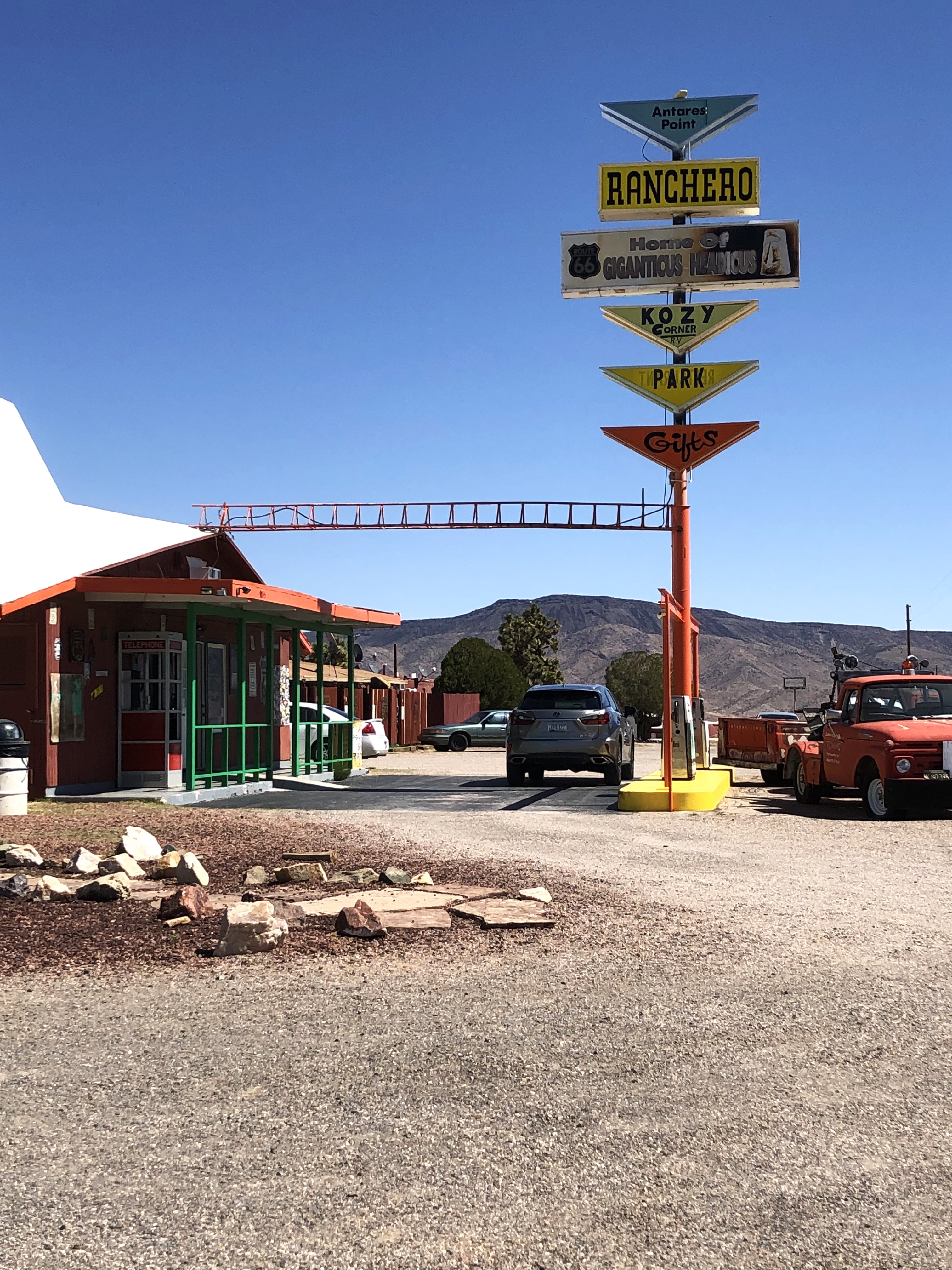
One of the sights Holland was keen to see, was the 'Giganticus Headicus': an imposing green 14-foot-tall tiki head, built in 2004 by an Arizona man named Gregg Arnold - he constructed the desert behemoth 😳 with chicken wire, cement, and Styrofoam.

'Giganticus Headicus' ~ Antares Point Visitor Center; 9855 AZ-66, Kingman, AZ

In 2021, the same man who designed and crafted the Giganticus Headicus,  also designed and crafted a colossus 16' tall feminine statue; crowned 'The Guardian of Route 66':


'The Guardian of Route 66' ~ Antares Point Visitor Center; 9855 AZ-66. Kingman, AZ

What attracts me to the old highway byways, is the old buildings that are never glimpsed from the fast-paced freeways kicked off during the 1970's era. Personally, I prefer the laid-back, scenic drives … admittedly, the roadways are trash - but the 'Atomic Age' Advertising Signs are still pretty cool to see: even in their original, dilapidated, state. MPO

'Space-age' Business Advertising Sign.
Googie Architecture
(https://en.wikipedia.org/wiki/Googie_architecture)

Alongside the building, sat a freaky Tiki; and a little, vintage, Nash Metropolitan car.

A freaky Tiki; and a Nash Metropolitan car.
Nash Metropolitan Car
(https://en.wikipedia.org/wiki/Nash_Metropolitan)

These things stand outside the Antares Point Visitor Center ~ which used to be Nickerson Farms Restaurant; a popular drop-in for road trippers back in the day, to refresh themselves and give their legs a stretch before continuing forward on their journey. After viewing the roadside draws … we went inside the gift shop, and bought a few Giganticus Headicus souvenirs 😉

Antares Point Visitor Center; 9855 AZ-66. Kingman, AZ

The Rancheros Motel opened around 1965, it's main features being the steep gabled roof - and a "space age" Googie styled sign with triangular shaped parts.

The Rancheros Motel and Shell filling station in the 1960s, US66 Antares.

This 1960s postcard, showed it at one time, advertising fr4om the rooftop: "Lake Mead Rancheros" followed by "Restaurant Bar Motel" and there was a Shell service station with the pumps under a canopy - the canopy, and pumps, are now gone; but the building still stands, refurbished by it's new owner, and is now, an operational Gift Shop today.

This is the MAIN Route 66 roadway.

Hackberry-AZ, was spread out over regions on both sides of the highway route … but due to time restrictions, we didn't meander too far from the beaten trail; we kept our sight-seeing ventures close to the road's edge:

Holland wanted to make sure I filmed these old vehicles; relics of Days Gone By; Hackberry-AZ

Hackberry-AZ: (https://en.wikipedia.org/wiki/Hackberry,_Arizona#:~:text=8%20See%20also-,History,based%20on%20fluctuating%20commodity%20prices.)

Charcoal Kiln; Hackberry-AZ

The charcoal kilns in Hackberry-AZ, were built in the late 1800's - and were used to burn wood down, into charcoal … which was then used as fuel in smelters for lead-silver mines, transported by pack animals or wagons to the smelters. Charcoal was preferred as a fuel source in mining furnaces because it burns more slowly than wood and produces a greater heat, which was necessary for refining ores.

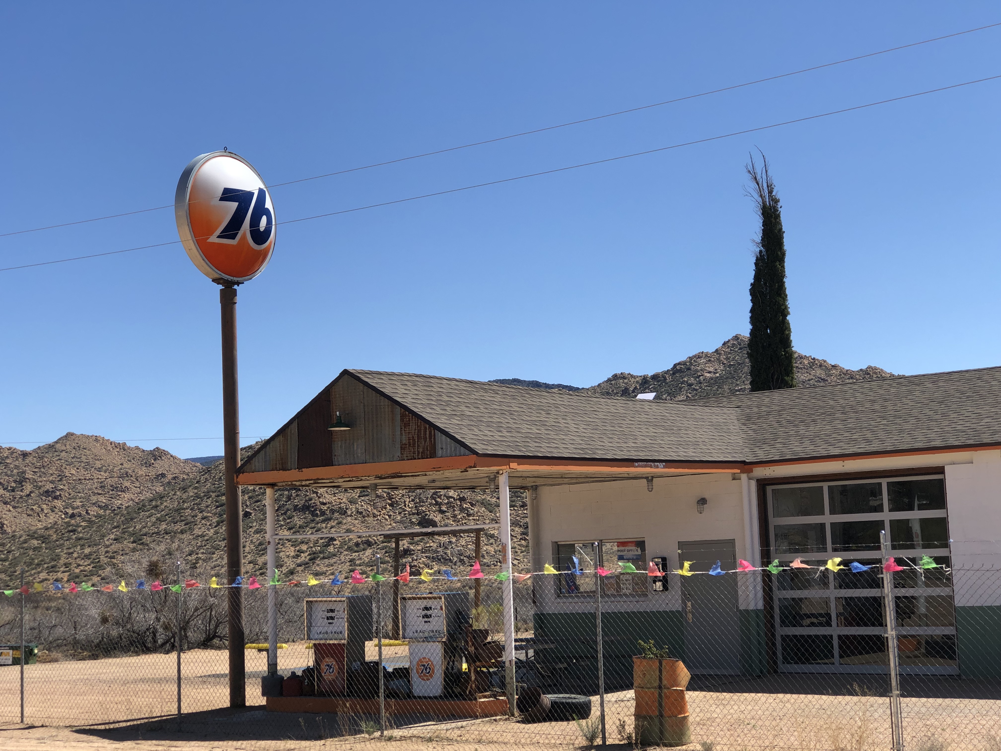
A hop-skip-jump further down the road, we saw signs that were throw-back moments for both if us 😁

76 Orange Globe Gas Station sign - youthful memories for both of us.
76 Gas Station
(https://en.wikipedia.org/wiki/76_(gas_station))
S & H Stamps Sign; another youthful gas Station memory for both of us; Valentine-AZ
S & H Stamps:
 (https://en.wikipedia.org/wiki/S%26H_Green_Stamps#:~:text=S%26H%20Green%20Stamps%20was%20a,Sperry%20and%20Shelley%20Byron%20Hutchinson.)
Valentine-AZ from Kingman-AZ; 38 min (32.4 mi) via Historic Rte 66
These fuel prices may seem like a bargain, but in actuality, they were still pretty steep: in today's monetary calculations, 27 cents per gallon in the 1950's would have been the equivalent of roughly $3.31 of today's fuel price.

From 1950 to 1952, the national price for a gallon of regular "octane" gasoline was 27 cents; premium gasoline "ethyl" was slightly higher. Quality built cars "muscle cars" would only run smoothly on premium quality fuel: cheaper gasoline would make them smoke and rattle, with less power. Ethyl fuel gave drivers more power and more mileage.

This tickled my funny bone when the sign tripped an old rock-n-roll song 😊
The Five Man Electrical Band - 1971 'Signs' song:  (https://www.youtube.com/watch?v=oeT5otk2R1g)
A man named Ruben, bought the Gas Station in 2006 - and has made it his home; with a Youtube Channel about Route 66.
Reuben - 'Welcome to Valentine Station'
(https://www.youtube.com/watch?v=DFrSEOMACaI)
I love the landscape of AZ - it varies from region to region. There is something here to satisfy everyone; Valentine-AZ
Holland missed the original entrance; so, down from the highway, we went …
Bureau of Indian Affairs (BIA); 13067 AZ-66, Valentine, AZ
A school with a sad history …
Truxton Canyon Training School:  (https://www.atlasobscura.com/places/truxton-canyon-training-school)
Leaving the area correctly - no grass hopping, this time 👍
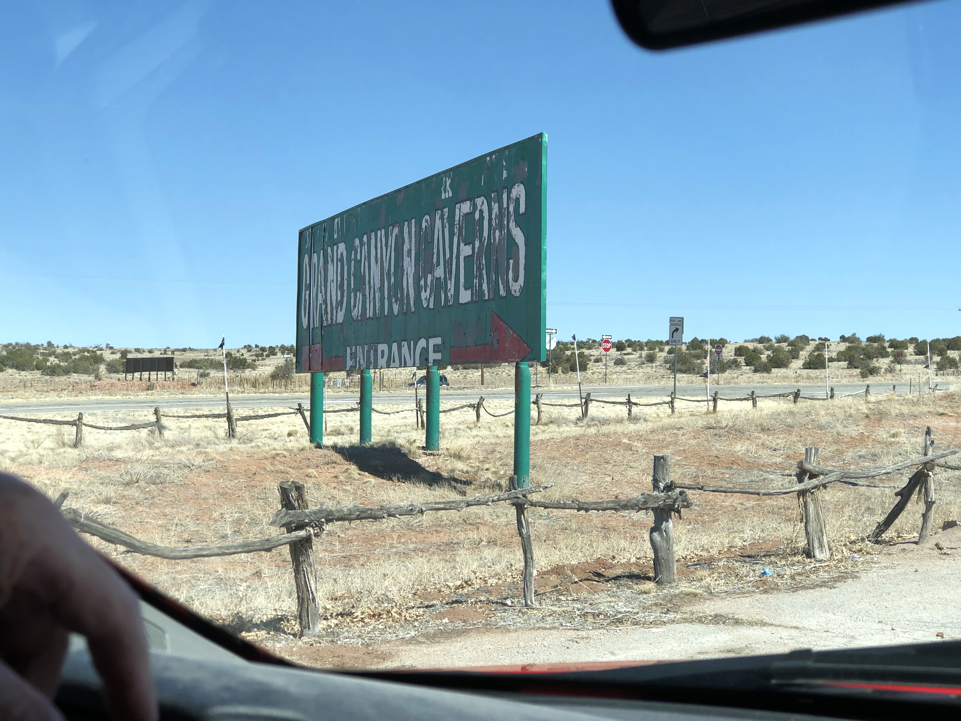
'Grand Canyon Caverns' sign …
Grand Canyon Caverns; Peach Springs-AZ:  (https://en.wikipedia.org/wiki/Grand_Canyon_Caverns)
This, to me, is a questionable endeavor.

Truxton was echoing 1950's vibes as we passed through - there wasn't much there to see, but Holland kindly pulled over to the side of the road, so I could snag a couple wisps of that bygone era of this Route 66 passage.


The funky atomic age motel signs, are always a draw for my eye 😉

Truxton-AZ from Kingman-AZ; 45 min (41.8 mi) via Historic Rte 66
The vintage Frontier Motel; 16118 E. Route 66, Truxton-AZ

The vintage 1951 Frontier Motel and Café welcomed Route 66 guests for several decades until it closed in 2011. The building is still standing, but no longer welcoming. The building changed hands with three different owners - the original owner Alice Wright in the early 1950's; the Barker husband & wife team, in 1957; and again new owners in 2014 with hopes of revamping & revitalizing the 9 units … but those plans stalled by late 2015 and so it sits lonely and forlorn, today.

Truxton Gas Station; 16111 AZ-66, Truxton-AZ
Truxton Gas Station
(http://www.ontheroadarizona.com/truxton.html)

To some people, these old buildings would not be appealing - but to us: Holland has spent a considerable amount of time on this very stretch of Route 66, when his mother drove through here on their many cross-country drives to Texas. It is all new to me … but I have long dreamed of traveling it, and viewing glimpses of vintage Americana - for me, this is the heart and soul of my Road Gypsy journey.


I am blessed beyond measure that Elohim has gifted my golden years with a husband, who loves me enough to do lengthy researches, and plan Daytrips to make my Route 66 dreams and wishes come true by deliberately making sure old gas stations and motels still standing … figure into our Road Gypsy itineraries. Holland prefers freeway travel, but he is doing these backroad drives solely for my benefit.

The Truxton Café (Frontier Motel & Café) in Truxton, Arizona, is not operational; it closed in 2011 … and the motel is still standing; but also closed.

The Truxton Café and Texaco Gas Station was one of the first businesses to be built in 1951, when Donald Dilts & his partner Clyde McCune, heard that a Dam would be built on the Colorado River at nearby Bridge Canyon. In hopes of benefiting from the anticipated traffic to the area, the two men built a service station and garage. They soon added a café to the site. Though the anticipated dam was never built, the business thrived due to abundant Route 66 traffic.

Truxton-AZ did okay with road traffic visitors until the opening of Interstate 40, which bypassed the town in September 1978 - then, the struggling town spiraled into decline. But, even though most of the town businesses are shuttered, Truxton is not a true ghost town because it is still called home to about 100 people in the area.

The next spot on the Map, was a place called Peach Springs - reportedly, Peach Springs was named after the peach trees planted at nearby springs by Spanish missionaries in the 18th century. These days, Peach Springs is the administrative headquarters for the Hualapai Reservation.

I took a couple pictures of the cool stone-faced buildings … then we pointed Betsy's nose towards today's intended goal.

Stone structured Peach Springs Trading Post; Peach Springs-AZ:  (https://www.nps.gov/places/peach-springs-trading-post.htm & https://www.historic-structures.com/az/peach_springs/peach-springs-trading-post/)
The Osterman Gas Station~aka, Hualapai Gas Station; Peach Springs-AZ: 
(https://www.knau.org/knau-and-arizona-news/2023-05-09/hualapai-gas-station-in-peach-springs-makes-list-of-americas-most-endangered-historic-places)
Funky highway leading to the 'Grand Canyon Caverns'; AZ-66, Peach Springs, AZ
Grand Canyon Caverns-AZ from Kingman-AZ; 1 hr 7 min (62.4 mi) via Historic Rte 66
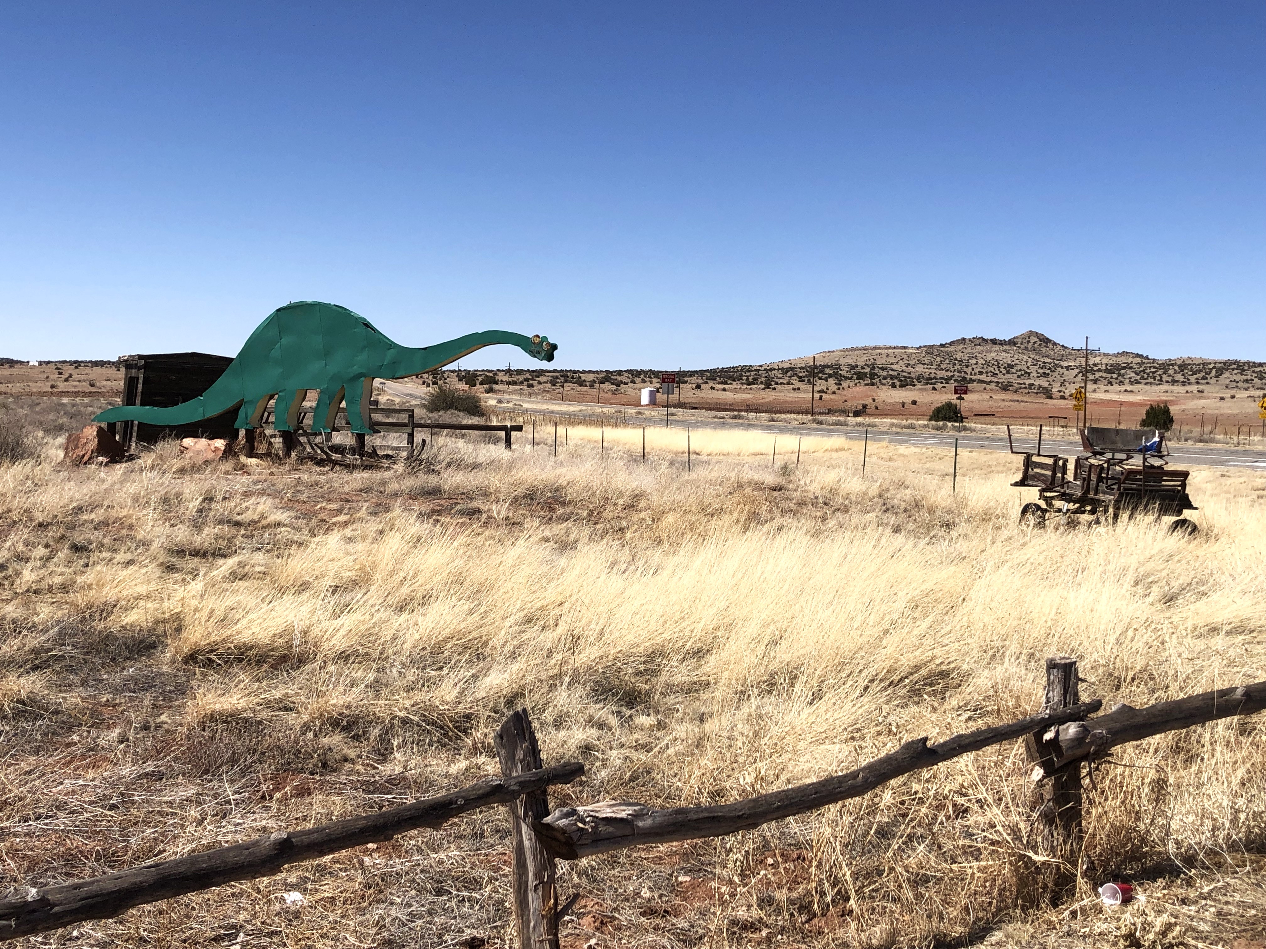
The land of dinosaurs and wagons west …
Cavern Inn Motel; Route 66~Mile Marker 115, Peach Springs-AZ
The Grand Canyon Caverns Road Sign; Route 66~Mile Marker 115, Peach Springs-AZ

We drove to the Caverns entrance road but we did not go to see them, because (1) they were 9 miles further up the dirt road (2) a registration was required: we didn't want to do any of that. But, when we were back on the main Route 66 highway, I said to Holland (who has mentioned before we passed this way today, that he remembers giant dinosaurs along the route to Texas - where his Mom would let the kids out to run and play); that this may very well have been that particular stop. He said the dinosaurs didn't look massive enough - but I said that he was a just a little shaver back then, and these dinosaurs would have looked massive to him at that time 😉

Holland's mother would have found various ways to keep the entertained during lengthy drives.

We are on the Route 66 route his mother drove, at that time.

We did see large scale dinosaurs.

And when we got back home and I did research of these places we visited on this Daytrip, it's a good thing we did not drive that dusty 9 mile drive to the caverns, because they are "permanently closed": research yielded this info - the Grand Canyon Caverns are closed to the public for safety reasons: in October 2022, a family touring the caverns became stranded 20 stories underground when the elevator broke down, and they were rescued after being stuck for 30 hours. "Cavern tours currently unavailable". However, while the caverns themselves are closed, the gift shop and restaurant are open, and the Cavern Inn Motel on Route 66 is also open and taking reservations.

We were on the way to Seligman - one of the stops along that route they would have passed through. Holland told me this Route 66 Highway "goes all the way to Oklahoma City", as well as Texas (I think both branches of his family lineage tree come from Oklahoma): Holland has relatives in every State branching out westward, from Oklahoma - and also in Louisiana, Arkansas, and Missouri. His Aunt Gaye, like his mother, also traveled this highway many, many times before settling in Arizona. Maybe, in my mind, I'll rename this highway: "The Harris Byway" 😂🤣

Route 66 Highway is Travel History known around the world.
The longest remaining segment of Route 66 of it's U.S.A. route, & ends at end of Oatman Hwy-AZ

The elevation of Seligman-AZ, is 5,243′ - and Holland was dealing with the onset of a migraine and struggling lungs, due to painful effects of the thin air; but he refused to turn back until we reached the destination point he had planned for today.

Snow on the high peaks …
Seligman Elevation …
Coming into Seligman-AZ

Seligman-AZ: (https://en.wikipedia.org/wiki/Seligman,_Arizona)

The Santa Fe Railroad line was a major railway that played a significant role in the development of the American West: a portion of the Santa Fe Rail Lines runs through Seligman and Kingman (I know this because I saw 'Santa Fe Railroad' signage on the rail trellis), connecting these towns and facilitating transportation and commerce - and of course, Highway Route 66 closely follows the rail lines … which, in turn, closely follows the National Old Trails Road; which incorporated the Santa Fe Trail, that was a commercial thoroughfare between 1821 and 1880. The Santa Fe Railway began construction in 1870.

The Atchison, Topeka and Santa Fe Railway: 
(https://en.wikipedia.org/wiki/Atchison,_Topeka_and_Santa_Fe_Railway)
National Old Trails Road: 
(https://en.wikipedia.org/wiki/National_Old_Trails_Road)

Judy Garland - 'The Atchison, Topeka and Santa Fe' song: (https://www.youtube.com/watch?v=_qBBc4lgO9I&t=1s)

As soon as you enter Seligman, you are immediately thrust into a time warp of a unique slice of the American experience: the whole place just shouts classic Route 66 - and enjoying the sunny drive with my husband, my mind's eye could imagine the steady stream of 50’s & 60’s traffic … as well as the cheerful motor inn hosts, quick paced hash slingers, and sprightly stepping, cheeky coffee-pouting waitresses; all doing their best to feed and entertain the visitors passing through their towns.

Vintage cars from various eras of Route 66 travelers.
Route 66 memorabilia … Seligman, AZ
We ordered lunch here; cheeseburger, fries & Peanut Butter Shake for Holland - Fishburger, for me~Delgadillo's Snow Cap Drive-In; #301 AZ-66, Seligman, AZ
Americana = echoes a a bygone era.
Now everything is backwards; you can't get into the military unless you wear pink undies; the air is dirty … and hedonistic sex is applauded.
Forks-WA: a recognizable notation.
Newspaper articles on Delgadillo's Snow Cap Drive-In
Founding member, Juan Delgadillo dies.
Cute Wile E  Coyote & Road Runner Banner, running the length of wall under the counter window.
Looney Tunes | Wile E. Coyote Takes On the Road Runner:  (https://www.youtube.com/watch?v=Zuc486qwfMY)
Juan's son, a jokester at the counter, served wacky humor while our order was taken at the Snow Cap counter.

After we finished off our lunch, we drove to the end of the Main Street's stretch - where we saw that the Stagecoach 66 Motel in, is still operational.

And that snowy mountain peak we spotted earlier seemed like it was situated up close and personal on the backside of Seligman.

The Stagecoach 66 Motel; #21455 W Old Hwy 66~I-40 Business Lp, Seligman, AZ
There's the snowy peak I saw as we neared Seligman-AZ

Driving back through Seligman, Holland pointed out the Barber Shop that keeps this time warp town in the green ... while Route 66 didn't originate in Seligman-AZ, the town is recognized as the "Birthplace of Historic Route 66" because of its role in preserving and recognizing the highway's history after it was decommissioned as a US highway. After Interstate 40 bypassed Seligman in 1978, local business people lobbied to designate Route 66 as a historic highway, and Seligman became known as the "Birthplace of Historic Route 66".

Holland also pointed out that the designation and preservation efforts led to an enthusiastic renewed interest in Route 66, whereby Seligman even inspiring the fictional town of Radiator Springs in the 2006 Pixar movie "Cars". My granddaughter loved that movie series.

Angel Delgadillo's Barber Shop where the concept of 'Historic Route 66 Association of Arizona' was born.
Angel Delgadillo
(https://en.wikipedia.org/wiki/Angel_Delgadillo)
'Cars' Movie Poster

Angel Delgadillo, known far and wide as the "Guardian Angel of Route 66" from Seligman-AZ, officially retired from his barbershop in 2022 at the age of 95. 

2023 President’s Award for National Leadership in Historic Preservation: Angel Delgadillo: https://www.youtube.com/watch?v=Jhu-lV6JnqE

Angel Delgadillo I Historymakers - 2023: https://www.youtube.com/watch?v=zYYIjKw6Lf4

Angel Delgadillo passed away peacefully at home on December 21, 2024. But his legacy lives on: Route 66 takes us back to our roots as Americans, back to a time when things were simpler, and the open road held endless possibilities. Driving it - and visiting the rural towns along the route - gives our world-weary selves a chance to appreciate our nation's great history and remember … the Route 66 road we drove today, is the longest remaining segment of Route 66 of it's U.S.A. route, and it ends at the end of Oatman Hwy-AZ, near the AZ-CA border line.

Kingman-AZ from Seligman-AZ; 1 hr 12 min (72.8 mi) via I-40 E
We took the long way home, on I-40 = completing a Loop Drive.
The Hualapai Mountains: 
(https://en.wikipedia.org/wiki/Hualapai_Mountains)
Coming back into Kingman-AZ
Right back where we started our looping Daytrip 😉

Today was a great day to have a great day 😁👩‍❤️‍💋‍👨